


Montrose P-2, Wright County, Minnesota
About
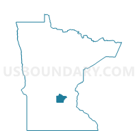
Outline

Summary
| Unique Area Identifier | 604996 |
| Name | Montrose P-2 |
| County | Wright County |
| State | Minnesota |
| Area (square miles) | 0.83 |
| Land Area (square miles) | 0.83 |
| Water Area (square miles) | 0.00 |
| % of Land Area | 100.00 |
| % of Water Area | 0.00 |
| Latitude of the Internal Point | 45.05169790 |
| Longtitude of the Internal Point | -93.92428000 |
Maps


Graphs
Select a template below for downloading or customizing gragh for Montrose P-2, Wright County, Minnesota


Neighbors
Neighoring Voting District (by Name) Neighboring Voting District on the Map
- Marysville Twp. Voting District, Wright County, MN
- Montrose Voting District, Wright County, MN
- Woodland Twp. Voting District, Wright County, MN
Top 10 Neighboring County Subdivision (by Population) Neighboring County Subdivision on the Map
- Montrose city, Wright County, MN (2,847)
- Marysville township, Wright County, MN (2,147)
- Woodland township, Wright County, MN (1,082)